GIS 5027 Module 5 - Unsupervised and Supervised Classification Methods
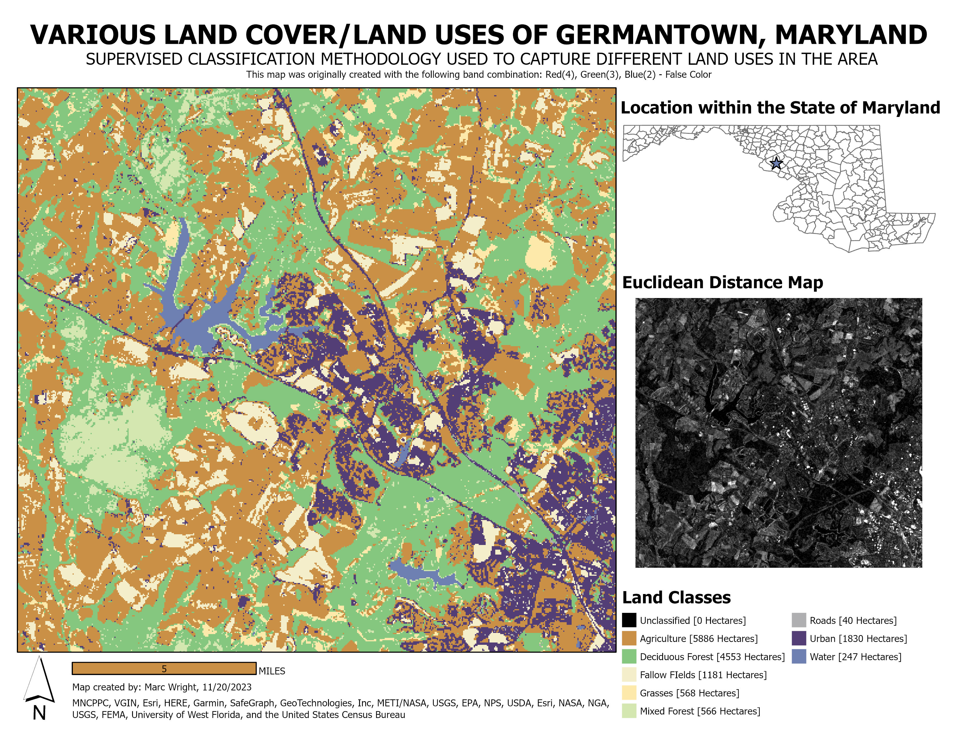
This week's lab assignment focused on Unsupervised vs. Supervised Classification methods. The first part of the lab explained how to perform an Unsupervised Land Use / Land Cover Classification on an aerial image of the University of West Florida campus. The second part of the lab walk us through the Supervised Classification method. This method is much more extensive and methodic, creating a more accurate classification map. As displayed above, our final deliverable for this project was a land cover / land use map of Germantown, Maryland. While I am happy with the quality of this map, I would like to know for sure what accuracy level the classifications achieved; not knowing this information concerns me to an extent. Also, if I had to redo this project, I would definitely change the initial band combinations of the original satellite image. For the map above, I went with a false color Red(4), Green(3), Blue(2) band combination. Other than these minor issues, this laboratory assignment was extremely informative and a nice set-up to dive into the final project...


No comments:
Post a Comment