Wednesday, September 13, 2023
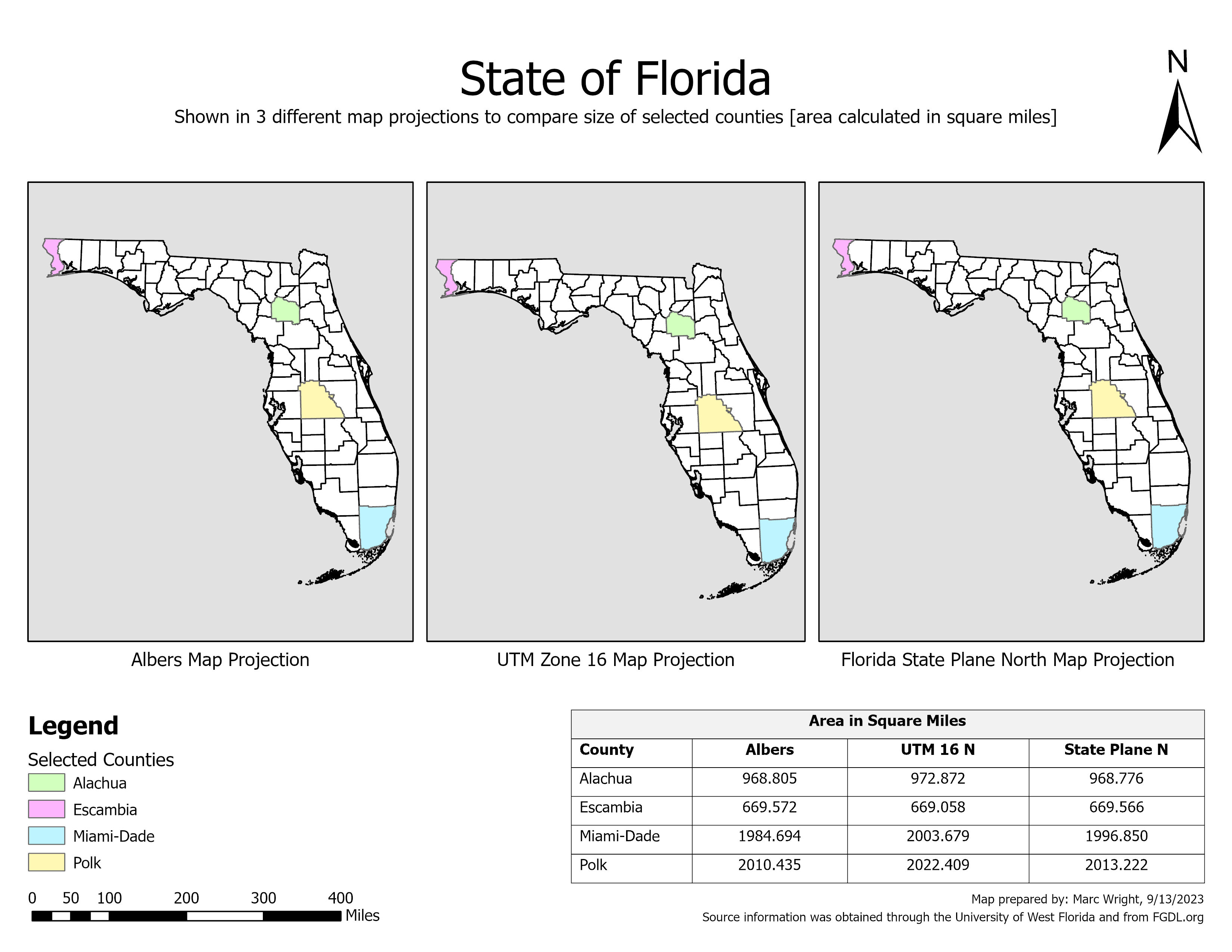
GIS 5050 Module 3: Map Projections
Subscribe to:
Post Comments (Atom)
GIS 6105 Module 6 - Interpolation
For the final map deliverable, I simply modified the map from Module 5 to create a sense of continuity between the two sequential lab assign...

-
 My research project for Remote Sensing and Photo Interpretation was modeled after a case study named " Mapping the Dynamics of Eastern ...
 -
Module 2.2 of Special Topics in GIS was an exploration of surface interpolation and some of the different methods that can be employed to pr...
-
The final module of Special Topics in GIS focused on scale / resolution, and data aggregation. The first portion of the lab explored two vec...


No comments:
Post a Comment